
Guide
How to Read a Course's Satellite Map and Yardages
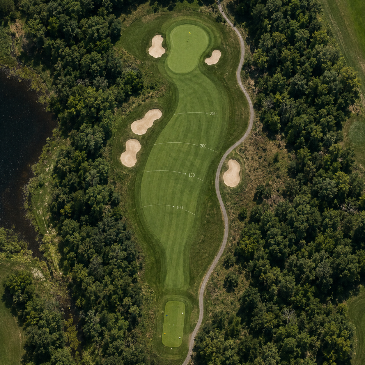
GolfView's interactive satellite maps show you every hole before you tee off. Here's how to use them to plan your shots.
Every course page on GolfView includes an interactive satellite map built from real aerial imagery, overlaid with hole-by-hole yardages. Before you even arrive at the course, you can trace the line of each fairway, spot bunkers and water hazards, and get a sense of dogleg angles that a scorecard alone won't show you.
Yardages on the map are measured from common reference points — usually the center of the tee box to the center of the green — so treat them as a strong estimate rather than a laser-precise number for club selection on the day. Combine the satellite view with the course's par and hole count (shown in the sidebar on every course page) to build a rough game plan: which holes reward an aggressive tee shot, and which ones are better played conservatively.
If a course has hole-by-hole data mapped, you'll also see a scorecard summarizing par and yardage for all eighteen (or nine) holes in one place, which is worth reviewing the night before a round at an unfamiliar course.
Yardages on the map are measured from common reference points — usually the center of the tee box to the center of the green — so treat them as a strong estimate rather than a laser-precise number for club selection on the day. Combine the satellite view with the course's par and hole count (shown in the sidebar on every course page) to build a rough game plan: which holes reward an aggressive tee shot, and which ones are better played conservatively.
If a course has hole-by-hole data mapped, you'll also see a scorecard summarizing par and yardage for all eighteen (or nine) holes in one place, which is worth reviewing the night before a round at an unfamiliar course.